
The beach at Laxey - with the tide almost fully in. Our route along the path will take us around that headland to the south east.

Looking along the promenade at Laxey - from near the harbour. With the tide in like this we had to take the 'alternative route' up a path through the trees, from behind the toilets, directly above the far end of the prom. The 'proper' route goes along the beach for a short way and then up a different path to meet at the quaintly named hamlet of Fairy Cottage.

Here is what it looks like with the tide out! That is actually a really nice sandy beach at the foot of the intial shingle - although this was a somewhat cloudy day and didn't show it at its best. Further along are a group of rocks on the beach which make a geat climbing area for kids - or alternatively a great place for a picnic!

Looking back towards the diminutive and pretty harbour at Laxey.

From Fairy Cottage we follow the road for a while and criss-cross the electric railway.

Electric trams pass fequently as we walk near Ballabeg.

And here's one going the other way...

This being the Isle of Man, lots of people wave as they pass.

Turning off the main road at a waypoint we head down an ever-narrowing road.

The sea peeps at us through the trees at one sharp bend.

Then we arrive at the absolute miniature gem that is Garwick Bay.

A short shingly beach and two boat houses. Unbelievably clear water - and that's it! An absolutely beautiful spot.We then head upwards again though woodland and a different path before turning up onto a narrow road past some expensive-looking houses.

Rising above the tree (and house!) line we emerge onto Clay Head.

Looking back, you can just make out the radio masts on top of Snaefell.

This is looking back to Laxey Bay - you can just see the prom where we started today.

Crossing the arid path over Clay Head was this tap. The sign reads "Welcome to Ballanette Public Footpath. Please help yourself to fresh drinking water". Note that drinking vessels are provided for both humans and dogs!

Looking ahead at a turn in the track we see Onchan Head in the distance.

At Ballacreggan the path takes us through some 'barn conversion' offices and some sort of business suite. Despite this, there was a sign inviting walkers to use their toilets and facilities! Its just not like the mainland is it?

From Ballacreggan - near Ballavaran - looking towards the coast.

In the distant trees is the tiny church where you will find that iconic Isle of Man Saxon Cross...
...This one!

The tiny church itself is still maintained and occasionally used.
The tiny churchyard has a number of interesting headstones.

As elsewhere, some of the oldest stones are kept sheltered.


From the same viewpoint at Ballavarann you can see Onchan Head and just make out the road we will climb later to go round it.

Leaving the through road at Ballavarann, we start to descend again.

This time we are descending into Groudle Glen: a gem in itself - but if that were not enough it also has an idyllic watermill and a steam railway!

Not the most inspiring bit of railway on this photo, but go there and see just how picturesque it is!I think it was along here that a cgi grim eastern bloc factory was created for use in the film 'Severance'?

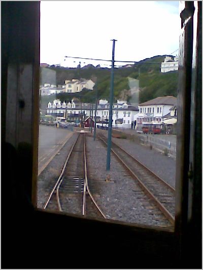
Looking the other way is a little more intriguing. Here is the (pedestrian) level crossing and a railway halt about half way along the line.
The official route into Groudle Glen means parking alongside the main Douglas-Laxey road at the hairpin bend (north or south side) and descending one of the steep paths to the bottom.

Once alongside the river itself, the path is more level. Here the main road bridge can be seen crossing the glen in the background.

Proceeding down the glen, you wonder if you are going the right way - but there a helpful little brown sign on a tree to reassure you!

This little path has some outstanding features...

...notably this watermill. It was originally constructed to provide hydro-electric power for the owners hotel!

Continuing down the valley, we approach the railway at last - but it has not been a tedious trek!

What a curiosity this railway is! Starting in the middle of a magical tree-filled glen.

Here a complete set of rolling stock are kept.

There is an engine shed and workshop - complete with 'spare' diesel loco.

At the other end of the line is a complete contrast. Here is a(nother) convenient cafe to reresh the weary traveller:-)Meanwhile, our little steam loco is fired up for the return journey.

In the background is Onchan Head - around which the coastal path proceeds.

Looking beyond the end of the line you can still see Sea Lion Cove and the remains of the Victorian sea-life pens which were the main attraction for the railway.


Climbing up the other side of the valley amongst some modern bungalows, we can look back and make out the green huts of the railway halt half way up the hill.

The higher we climb - and it is easy going up this road - the better the view out to sea.

Reaching the main road around Onchan Head it is still possible to make out the two huts we passed earlier on the Groudle Glen railway.

Higher still the track route can be seen curving round the headland to Sea Lion Cove and the railway's outer terminus - with its new station roof just visible.

This was the entrance to the former Howstrake Camp. Originally a wartime internment camp, it later became a holiday camp but is now completely flattened - apart from this bus and tram stop. In the distance, the harbour at Douglas appears for the first time as we approach journey's end after our circumnavigation of the island.

Looking back, we have walked from the far side of those hills today. That is Clay Head in the distance.

As we start our very last descent - down into Douglas Bay - the coastal path has one final twist...

Following the waymark down through the heather takes one down some very dodgy wooden steps. This is so steep that one has the feeling that one is about to tip headlong over the edge of the cliff. Those with any sense of vertigo are strongly advised to keep stepping on down the road!

In an unusually frank notice, the Isle of Man briefly adopts a characteristically mainland attitude to safety. The sign reads, "Caution Beware Cliff Edge". Does some idiot really think we could have come this far and not noticed!?

Fortunately the path then levels out through some bracken as we approach housing on the outskirts of Douglas.

This is a curious bit of path. The Isle of Man authorities are to be commended on trying to keep the coastal path near the edge BUT it is quite clear some residents are very much against it - except for the purpose of emptying their dogs!

Having got back to the road for the last time, we looked back at that detour. Some residents have gone to great trouble to make 'their' bit of path easy walking whilst others have done their best to obstruct it with grass cuttings, hedge clippings and the like. This we found very sad and not in the spirit of the rest of the walk or, indeed, the island.

A short, easy road detour takes us round the last bit of Onchan Head.

Even this close to the town there are some good sights to see (sea?).

Almost back a sea level - for the last time - we are overtaken by another tram 'pair' as they also approach the end of their line.

Yet another Isle of Man lost asset? This appears to have been some large theatre - or similar.

Looking back, the eye-catching 'Hollywood' style signs can be seen across the bay.

Beneath the sign is the maintenance depot for the electric railway.
This is the 'tram's-eye-view' of the Douglas terminus.
Literally, 'the end of the line'.


Passing by on our walk, we see the trams being 'put to bed'

All very neat and tidy - note the hanging flower baskets round the doors.

And so, the last mile or two along the 'prom'...
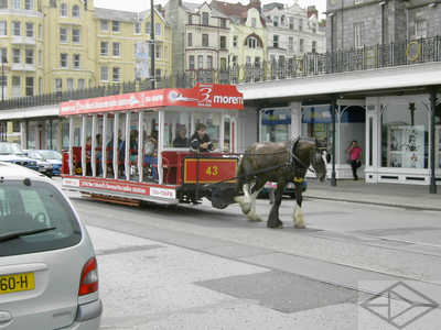
...probably seeing a couple of the horse-drawn trams along the way...
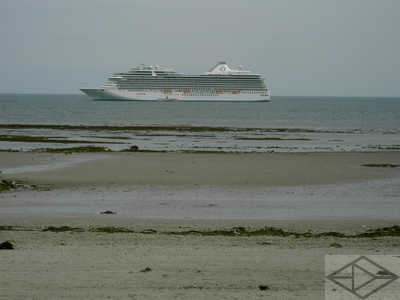
...or even one of the huge cruise ships that visit sometimes - beyond the expansive beach...

...back to our starting point, alongside Douglas Harbour...

...where the lift bridge guards the inner sanctum for the cruising boats. To the right of course is the hill where we started our walk up the steps so many days ago!
Finally, leaving the island is always sad - a last look back from aboard the fast catamaran 'Snaefell'. This journey only takes about 2 hours to Liverpool.

Arriving in Liverpool is always interesting. The docking is generally very quick and the traffic is guided rapidly away from the city centre. However it would be nice sometime to have a look around...
