
After leaving Kirk Michael Station, a good path continues along the old railway track.

Looking back at the same point, the station buildings can be seen in the distance.

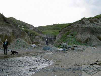
Meanwhile, beneath the first overbridge, is a surprisingly complicated, and picturesque, group of crossings and junctions.

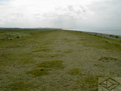
Continuing north, the railway keeps pleasant walking - and is popular with the residents of adjacent Kirk Michael.
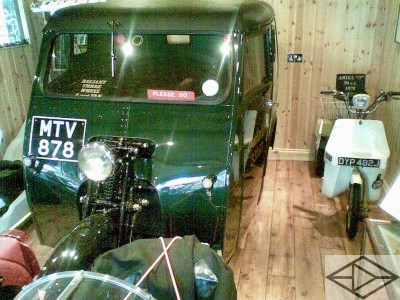
Also at this end of the village is this classic private motorcycle collection.

Opening hours are unpredictable (ie high days and holidays - and obviously during TT week) but do get to see it if you can.

As well as a remarkable number of ranks of classic machines...

...there are some oddments like this motorcyle 'trike' based van...
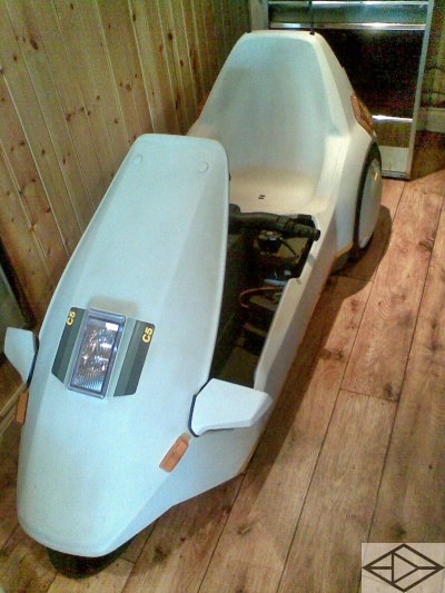
...or this rare surviving Sinclair C5!

To the north of Kirk Michael, we leave the railway route for the last time at this footpath 'crossroads'.
As we now head seaward again, the line of the former railway can be seen curving to the right as it heads for Ramsey - and its former terminus.
Incidentally, this is the nearst place to Ballaugh Bridge; one of the best places to watch racing - as motorcycles frequently leave the ground as they cross the hump of the bridge.


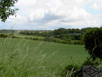
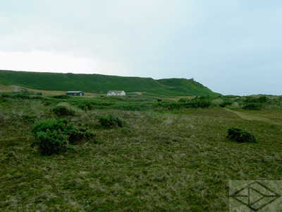
On our way to the sea, we pass a couple of small homesteads - almost hidden amongst the rolling fields.
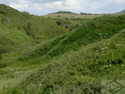
The path emerges at the sea via the grassy Glen Trunk.
It seems typical for glens on this part of the island to emerge like this - with a small waterfall and a footbridge.

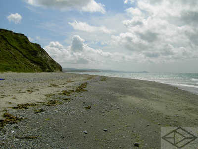
Once down to the sea, the clean, deserted beach opens up in front of us again. Between here and Maughold Head, to the east beyond Ramsey, there are sections of the path which can be covered by the sea at high tide. Therefore planning your walk is advisable. We used a neat little (free!) computer program called WXtide to predict things for us and even which week to book our holiday for the times we were likely to be walking!

Having walked on this, kicked it and smelled it, I was still not sure whether it was wood, fossilized tree, rock or hard clay! Interesting nevertheless.

Despite our efforts to keep out of the way of the tide, there were still some sections where we have to walk through a green-covered boulder field.

Looking south - back the way we have come - towards Orris Head in the distance.

Rounding another headland near The Cronk, we say good bye to Orris Head.
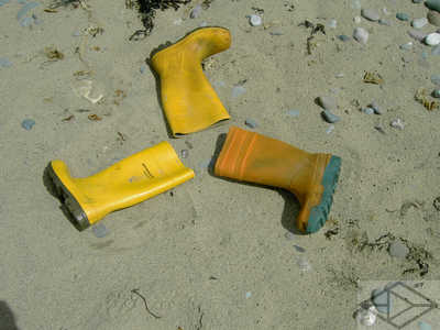
The three legs of man - fisherman's boot style! There is a lot of deposited flotsam along this length.

This lobster pot was another piece of flotsam left at the entrance to a sandy cleft in the cliff. The cliffs along here are quite sandy and soft and so are being slowly eroded. Entering any of these caves is inadvisable as they can easily collapse.
Rounding Jurby Head, the beach became somewhat shingly - but this may well have changed by the time we go again. So many beaches! - so many possibilities!

At Sartfield is this distinctive pipe which leads down from the sewage treatment plant. You can follow the road over the dunes here to Jurby Airfield where the buses run to.
The enigmatic Stella posing on a visiting car outside her world-renowned emporium 'Jurby Junk'. This is situated at Jurby Airfield. Words simply cannot describe the mass of junk and books that reside within those two warehouse units!

Near closing time, in a scene reminiscent of the Hitchcock's "The Birds", the seagulls await Stella's emergence to give them their supper!


Back on the beach, the tide has fallen - revealing yet more of the pipeline!

Heading north of Jurby is this magnificent beach. Where are Pink Floyd and a load of hospital beds when you need them :-)

Looking to the north, this is our way forward.
We were somewhat surprised in 2009 to find the beach covered in less pleasureable shingle - presumably a result of winter storms? Lets hope the beach is back to sand by the next time we go.

In 2011 the shingle had gone and our walk northwards was accompanied by a seal, who kept pace with us for several miles. It kept popping its head up every few yards just to make sure we were still there! Approaching Blue Point, and its distinctive derelict coastguard station, the seal left us to join a companion and we were left alone again.
Inland at Andreas, is a rather unusual church - with an almost separate tower. Like many on the island, it contains old saxon crosses - but there are many in here, and well worth visiting

The large graveyard is kept very tidy.

A walk among the stones is fascinating if you look at the names.

he south wall has been strengthened by these 'only just flying' buttresses.

The unusual interior of the church has a very fine rose window.

Unfortunately my camera failed to do this justice.

But that's a bit better. Go and see it yourself!

Below the cross on the eastern gable is a tiny smiling head.

Viewed from the end of the graveyard, the view is quite fine.

A 'Stafford' - a possible relation?

The old 'ball and cross' from the top of an earlier version of the tower. This is referred to in the church history so it seemed a shame to find it dumped alongside.

The low, green hill just beyond the church boundary, is actually an ancient earthwork.

Looking to the south-east are the mountains in the centre of the island and Ramsey a distant dot.

From near Blue Point the shingle starts in earnest. In fact it is continuous, and permanent from here to the Point of Ayre. The coastal path moves behind the dunes on a sandy route which is much easier walking than the shingle.

Although one can stil hear the surf breaking on the shore, it is quite a pleasant change to walk amongst heather, bracken and gorse and watch and listen to the wildlife as we pass by a golf course.

Continuing north through this area - known as The Ayres - we join a tarmac road at the southern end of the Ayres nature reserve. From here the Point of Ayre lighthouse can be seen in the disatance.

This seems to be as busy as it gets - one parked van!
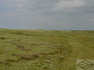
After leaving the tarmac, a pleasant grassy path continues through the increasing heather.

I fact there are several paths and a couple of, what appeared to be, standing stones. Closer examination reveals they are pierced with symmetrical holes - which then gives away the game that they are probably just former fence posts!
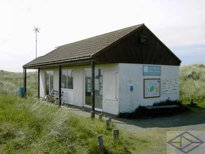
The Ayres visitor centre is a fairly small affair - which was closed when we passed by - despite opening hours to the contrary! We saw only two other people here. Through the window we could see a number of potentially interesting interpretation boards and a small shop. Fortunately, the toilets were open!

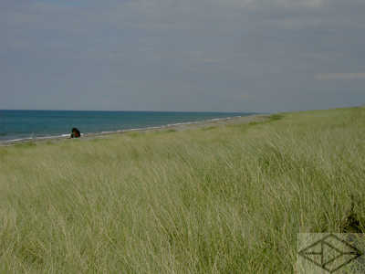
A short walk through the dunes at the visitor centre and you can see the 'shortness' of the shingle beach as we look south.
Looking north we see a solitary angler taking advantage of the deep water close inshore all the way along here.
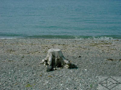
More strange things on the beach! An apparently fossilised tree stump was presumably deposited here in some storm.

At this point we started to experience sea breezes from both side of the island as we approach the extreme northern tip.

Just in case we were lost :-) We reached the Point of Ayre on what seemed to be quite a busy afternoon. There must have been at least twenty people there!
Looking back whence we had come, the nature of the shingle bank becomes clear as we leave the last of the sand dunes behind.

As has been seen, the lighthouse can be seen from severl miles away. just to the left can also be seen the former foghorn.

At the Point of Ayre - the end of today's walk - is this tall lighthouse.A strange place the Point of Ayre. It is here that strong sea currents - which have travelled up either side of the island - meet and combine before heading off toward Galloway in Scotland. It is these same currents which, over millenia, have moved rock, sand and mud from further back along the island to this point. This process of coastal erosion and deposition has created this whole flat triangle to the north of the mountains which stretches from Ramsey back across towards Sulby and Jurby. The process continues!