
If you have read the Coastal Path sections of this website first you will have seen plenty of images of Peel - so I won't bore you by repeating them here. If you haven't, then a look at the end of Day 5: Dalby to Peel, or the beginning of Day 6: Peel to Kirk Michael, which should give you the idea!Our walk was done in uncharacteristically bad weather, which got progressively worse during the day, to the point where we quit half way along at the Round Table crossroads and resumed on another day to complete the walk. In good weather, especially after a dry spell, this should be a relatively straightforward walk.

At the head of the harbour in Peel are some relics of the steam railway that terminated here on its near-straight route across the island from Douglas. This line closed in the early 1960s but would be very useful if reopened today. Here are an original water tower and a restored coach on a remainder of track.

Here also is a small, but packed, museum displaying outside more railway memorablia. These include a sign from the old route to Ramsey and a map of the heritage footpath route along the old trackbed.

In the museum windows are some old posters advertising the railways - but I have yet to find time to venture inside!
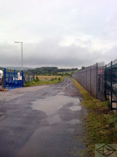
Leaving the museum, an inauspicious road - in fact, the old railway trackbed - takes us between industrial units and past the Peel power station before reaching open fields after a couple of hundred yards.

A short pleasant stretch through open fields, the trackbed reaches some woodland and passes alongside the river for a while. The sluice here, originally for a mill, now supplies cooling water to the power station we passed previously.

Leaving the railway route at the next bridge, near Glanfaba, the Herring Way crosses the bridge and then up behind the houses on a narrow but pleasant tree-lined track.

The narrow trackway continues upwards, above the nominal tree line, and winds around a couple of fields before reaching Knockaloe Beg. Beyond, the trackway continues to zig zag up the hill to the distant coll.

Looking back, from a little further up the track, there is a grand view back across the valley towards Douglas.
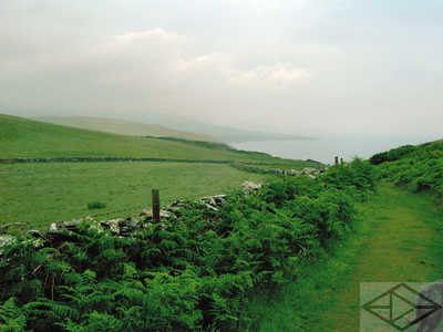
Crossing that coll above Knockaloe, the route arrives in sight of the sea once more. Shortly we will join with the Coastal Path for a couple of miles as we head south towards Glen Maye.

At the actual junction of the paths, there are good views south towards Niarbyl Point. The joint route is a good grassy path between the field boundary wall and gorse along the cliff top.

At Dreem Long the paths run along the edge of the field.

At Gob Ny Chassan it goes out again - but the path is protected by a fence.

Around Gob Ny Sharray the path crosses out of the fields for the last time.

Despite ongoing spectacular views down to the sea, this section of the path, near Traie Cronkan is rather uneven but is a much better surface than some of the coastal path. Therefore it shouldn't be so much of a problem to those with a fear of heights.

From the north side of Glen Maye, we can look down the coast toward the point at Niarbyl.

The glen is steep sided, but very beautiful - especially the higher you go. Whilst the coastal path zig zags up the hillside to the right, the Herring Way caries on up the glen on top of the left hand side of the valley.

After a gentle descent into Glen Maye, the floor of the valley contains a road and other paths. Here also is the site of a former waterwheel.

This is a close-up of the inscription on the wheel case.

Adjacent to the wheel case a path through a picnic area takes you towards the waterfall. This is not the 'proper' Herring Way but a very worthwhile alternative route.

The waterfall itself is well worth seeing. The path continues upwards...

...and over the head of the falls as it approaches the Waterfall pub.

Our four-legged friend decided he needed a nap at the pub :-)

In the village of Glen Maye, the actual glen turns into Glen Mooar - one of at least three by that name on the island! - and after following the 'postman's path' behind the houses across, and just down the road, from the pub we cross this simple footbridge.

A short distance along this path it joins a more solid track by this waymark.

Even in the increasing rain, this glen shows its considerable beauty.

This part of the glen is actually driveable from an access near the mines high on the hills towards Foxdale.

There is some evidence of former quarries - but most sites are now well reclaimed by nature.

Not far from the previous photo, our route deviates from the metalled road downwards gently on this stone-surfaced, and easily walkable, track.
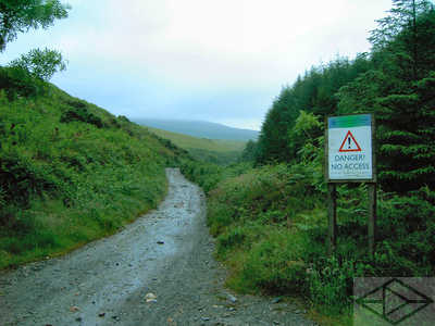
The sign on the right refers to the old quarry workings and not to our way ahead which now starts the steady climb to the highest point on our walk; near South Barrule in the far distance. From this point the Glen changes its name for a second time, to Glen Rushen, but there are two routes through it.

Just before reaching this spot near an old water cistern, we decided once again to deviate from the 'official' Herring Way because of the increasingly unpleasant weather. We opted to keep left on a direct path up to the Round Table crossroads rather than follow the 'proper' path to the right on a dog-leg which includes nearly a mile of extra road.

The next short section is rather step and stony. We were amazed to be passed here by a cyclist in the rain!

Looking back we were rewarded by an excellent view. However, on a clear day this could have been so much better!

Still heading uphill, this pleasant wooded section takes us almost to the crossroads.

After crossing the Round Table crossroads, we start the gradual descent to Castletown by another stony track between pine woods. This is a good point at which to leave a vehicle - or else at the car park in the woods just on the road to the south.

Emerging from the woods, the view to the south east shows Castletown, our destination, in the furthest distance.

At this point also we found an unusual white example of the fuschia plants that colonise the Isle of Man - instead of the usual red. Later on this walk we came across a number of similar examples.

A little further on the route reaches the hamlet of Yn Rheash

Looking back we can see our route down from near South Barrule.

After a short walk along a 'B' road, the Herring Way turns down this lane, signposted 'Old Moaney'.

From Glen Moar the metal road turns into this muddy track. In good weather this would be really nice - but not after our wet spell!

As we head on down the track, we did anticipate that worse mud might be to come!

The central grass strip did however contain an abundance of these flowers - which I believe are some type of orchid. They are very beautiful anyway!

After a particularly muddy field corner, where cattle had destroyed the path, we settled for this muddy trackway - complete with flowing water! - on the approach to Moaney Moar Farm.

This farm is isolated but in a really pleasant spot.

Leaving the farm, and its idyllic setting, we reached a metalled road once more with some relief!

A little further on we could look back and see almost all our route so far from South Barrule.

"I'd like to take a few scallop shells home with me!" As well as hardcore to combat mud, these shells are often used as a constituent of fertilizer.

At the end of the farm lane, we join the main road for about half a mile.

At the foot of the hill, on the other side of the road, we enter Silverdale Glen.

Silverdale Glen is very beautiful and obviously something of a holiday destination. Here however is the sluice which takes a feed off the river for the mill pool lower down.

The mill pool is now something of a boating lake-cum-duck pond!

A restored mill wheel is still in working order here attached to shops, a cafe and craft units.

After crossing a minor road, take the higher of the two paths down the glen.

This path passes this holy well. The inscription reads,
"In memory of our ancestors, who, through long ages, came to this well and here, in simple faith, made prayers and vows with humble offerings. -- So this became a holy place".

After both paths combine into one, it reaches Monks Bridge at Ballasalla.

After passing the remains of Rushen Abbey and going along a short road section, the Herring Way once again takes to an 'edge of field' path.

The 'edge of field' path then also becomes a riverside path.

The riverside path then becomes a parkland path in the final approaches to Castletown - but the riverside path does continue on the other side of the wall.

This last over-bridge carries the steam railway over both path and river. We managed to avoid the temptation of both pubs here...

Finally, in the sunshine, we arrive at the picturesque harbour in Castletown - and the end of the Herring Way.