
At the upper end of the harbour is the station for the steam railway in Douglas.

Leaving the station at Douglas, which the line to Peel shared with the current line to Port Erin, the two destinations shared the same route for a few hundred yards before diverging. The remains of the route to Peel briefly survive as a siding over this short stretch.Although the remaining line bends to the left towards Port Erin, the former line to Peel, and once also Ramsey, continued straight ahead - sharing the same station. These lines closed in the 1960s. Reopening the line to Peel would be very beneficial in moving around the island without using a car!

The Peel route (in the foreground area) ran parallel with the extant route to Port Erin for a short distance until the latter veered off across the River Dhoo.

Continuing behind today's industrial estate, the route remains - and even if not reopened, ought to be used as a continuation of the 'heritage trail' which starts a little further on so that walkers and cyclists can reach right into Douglas again.

The next road crossing is still in place with a viable bridge (also carrying the road across the river).

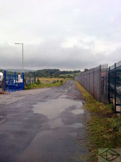
From the bridge, the route continues behind the fire station - only being blocked by a few parked cars until the Quarter Bridge is reached.

From the Quarter Bridge, the route is well used, both as the 'Heritage Way' - which is now continuous to the former terminus at Peel - and also as an access route for TT traffic during the summer racing fortnight.

After passing under Braddan Bridge the route passes the Joey Dunlop foundation building and then enters an attractive tree-lined phase.

For the next mile or so this well-surfaced section is quite heavily used by commuter cyclists, walkers and dog excercisers. It is however a very pleasant section and has the River Dhoo alongside most of the way.

The tree-lined section continues - as we are now not far from Nobles Hospital and footpaths cross.

..and it is the railway's turn to cross the river we have been following.

Not much further on we approach Union Mills, where the long platform remains.

Also here is a railway crane on a short length of track.

The main road bridge at Union Mills still exists - and there is an excellent pub (The Railway) just over to the left.

Beyond the bridge, a footbridge now replaces the original railway bridge as we cross back over the River Dhoo. This however is only the second real obstacle to restorers since Douglas!

Rapidly leaving Union Mills, the route heads out into open country again on its way towards Glen Vine and Crosby.

Around Glen Vine the trackway has a reasonable surface on it - even tarmac in places - and is used as an access road to farmland and, during TT fortnight, as an 'escape route' from Glenlough campsite.

The former crossing at Crosby - still with keepers hut - leads us onward past playing fields and back into open country.

About four miles of pleasant country now follow. Fields are interspersed with wooded sections.

Near the Rhenny Plantation, a footbridge has been placed over the remains of the original bridge to cross the Greeba River

Approaching the crossing at Ballacurry, a perfect section of trackbed in almost original condition. Just add rails?

At Ballacurry itself, a former level crossing for an access road is closely followed by this erstwhile river crossing.

Another crossing for a minor road at Kerrowgarrow.

Approaching St Johns, looking back east at the Curragh Road crossing, a keepers cabin remains.

Just before the site of St John's station, the Douglas Peel route is crossed by the route of the Foxdale branch . This unusual connection - whereby the branch crossed over the Douglas Peel route before connecting with the Manx Northern Railway route at the station - I can only explain by the fact that the two companies were for some time separate. Ie the Foxdale branch and the MNR were owned by one company and the Douglas-Peel route by another - but they did connect operationally at St John's station, and go through different track layouts, before the two companies were eventually combined.

Looking west from the level crossing at the St John's station site (currently a car park), double tracks at one time crossed here with the left one being for Peel and the right being for Ramsey or Foxdale. Note also that the road is starting to climb to cross the Foxdale branch by a bridge to the right.

A further current parking area was previously the site of sidings and the junctions with the Foxdale branch and the rest of the MNR .

About 1/2 mile west, at the crossings of the River Neb, the two tracks, which had run parallel since St John's, eventually separate. This photo is looking east with the Douglas-Peel route on the right and the Ramsey route to the left. Note that the Ramsey route is already climbing prior to crossing the nearby Douglas-Peel (A1) road. Train racing was common to this point and several old photos show this!

From St John's the track route is once again in attractive countryside - which continues all the way to Peel. This area near The Abbey is typical.

Or this near Ballawillyn.

Near Glenfaba is this attractive section by the River Neb. Near here the river course has changed a little in the last century. This has masked the site of the former junction with a short branch to Patrick and Knockaloe . This branch was built to serve the former Knockaloe, First World War internment camp.

The mill at Glenfaba has had its water wheel refurbished - however it no longer functions and the former leat from the river is now incomplete and overgrown. The adjacent bridge carries the A27 road over both railway and river towards Patrick and Glen Maye.

Continuing through some woodland, the trackbed passes alongside the river for a while. The sluice here, originally for another mill, now supplies cooling water to the power station we will pass as we reach Peel after a short pleasant stretch through open fields.
Approaching Peel, the old railway trackbed takes us between industrial units and past the Peel power station. This is looking east, more or less on the site of the Glenfaba brickworks which had its own tramway to its claypits. The two lines crossed at right angles near here.

At the head of the harbour in Peel are some relics of the steam railway that terminated just beyond here on its near-straight route across the island from Douglas. Here are an original water tower and a restored coach on a remainder of track.

Here also is a small, but packed, museum displaying outside more railway memorablia. These include a sign from the old route to Ramsey and a map of the heritage footpath route along the old trackbed. There is also an example of the smallest ever production car - the Peel P50.

The former station building at the Peel terminus is now part of the House of Mannanan museum. Tracks reached here from the right.

Original ironwork is clearly visible.

The original station pedestrian entrance has barely changed compared with old photographs.